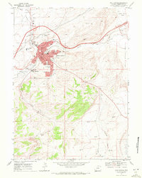
1968 Map of Rock Springs
USGS Topo · Published 1972About this map
Rock Springs stands at the center of this 1960s landscape, where the Union Pacific railroad and the Overland Trail converge along the banks of Bitter Creek. The map documents a town deeply intertwined with industry and education, featuring the Powerplant and various schools including Lowell Sch, Washington Sch, and Roosevelt Sch. To the west, the Western Wyoming Community College campus is visible, while Blairtown lies just to the south near the Sewage Disposal and the rail lines.
Find a feature on this map
31 named features on this map. Tap any name to fly to it.
Don’t see what you’re looking for? This feature index may not catch every label — zoom into the map to look around manually.
Map Details
Editions of this 1968 Rock Springs Map
3 editions found
Other maps of this area

1908 · Rock Springs
USGS Topo · 1:62,500

1910 · Rock Springs
USGS Topo · 1:62,500

1954 · Rock Springs
USGS Topo · 1:250,000

1957 · Firehole Basin
USGS Topo · 1:62,500

1958 · Rock Springs
USGS Topo · 1:250,000

1961 · Pilot Butte
USGS Topo · 1:24,000

1961 · Kanda
USGS Topo · 1:24,000

1962 · Rock Springs
USGS Topo · 1:250,000

1966 · Firehole Basin
USGS Topo · 1:62,500

1968 · North Baxter
USGS Topo · 1:24,000