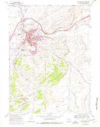
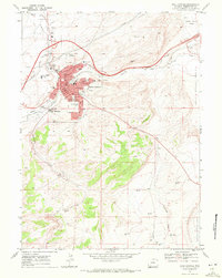
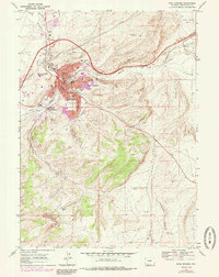
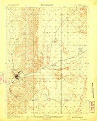
1968 Map of Rock Springs
USGS Topo · Published 1978About this map
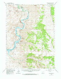
Rock Springs serves as the industrial and civic anchor of this 1968 landscape, situated where Killpecker Creek meets Bitter Creek. The town is mapped in great detail, showing the expanding campus of Western Wyoming Community College and numerous local schools like Lowell Sch and Washington Sch. The surrounding terrain of the North Baxter Basin and South Baxter Basin is defined by a legacy of resource extraction, with the Swanson Mine to the north and the Rainbow Mine and a Strip Mine located further south near Quealy.
Find a feature on this map
33 named features on this map. Tap any name to fly to it.
Don’t see what you’re looking for? This feature index may not catch every label — zoom into the map to look around manually.
Map Details
Editions of this 1968 Rock Springs Map
3 editions found
Other maps of this area
1908 · Rock Springs
USGS Topo · 1:62,500
1910 · Rock Springs
USGS Topo · 1:62,500

1954 · Rock Springs
USGS Topo · 1:250,000
1957 · Firehole Basin
USGS Topo · 1:62,500

1958 · Rock Springs
USGS Topo · 1:250,000
1961 · Pilot Butte
USGS Topo · 1:24,000
1961 · Kanda
USGS Topo · 1:24,000

1962 · Rock Springs
USGS Topo · 1:250,000
1966 · Firehole Basin
USGS Topo · 1:62,500
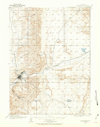
1968 · North Baxter
USGS Topo · 1:24,000