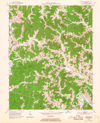
1952 Map of Rockholds
USGS Topo · Published 1968About this map
Rockholds and its surrounding mountain hollows appear in this mid-century survey as a landscape defined by small-scale coal extraction and rural subsistence. The Louisville and Nashville railroad tracks follow Watts Creek, providing the primary industrial link for this part of Whitley County. Numerous Strip Mines are mapped along the higher ridges, including Bunch Mountain and Chestnut Oak Mountain, signaling the shift toward surface mining in the post-war era.
Find a feature on this map
85 named features on this map. Tap any name to fly to it.
Don’t see what you’re looking for? This feature index may not catch every label — zoom into the map to look around manually.
Map Details
Editions of this 1952 Rockholds Map
4 editions found

Other maps of this area

1886 · Cumberland Gap
USGS Topo · 1:125,000

1888 · Cumberland Gap
USGS Topo · 1:125,000

1890 · Williamsburg
USGS Topo · 1:125,000

1891 · Cumberland Gap
USGS Topo · 1:125,000

1894 · Williamsburg
USGS Topo · 1:125,000

1952 · Corbin
USGS Topo · 1:24,000

1952 · Wofford
USGS Topo · 1:24,000

1952 · Barbourville
USGS Topo · 1:24,000

1952 · Heidrick
USGS Topo · 1:24,000

1952 · Vox
USGS Topo · 1:24,000