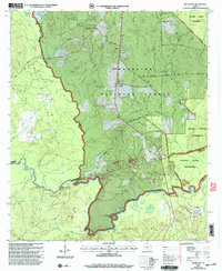
2003 Map of Rockland
USGS Topo · Published 2004About this map
The Neches River carves a winding path through the heart of the Angelina National Forest, defining the boundaries between Angelina, Tyler, and Jasper counties. This 2003 revision reveals a landscape shaped by both early history and conservation, most notably at the Historical Monument (Site of Fort Teran) located along the riverbank. The river's path is marked by dramatic geographical features such as Big Bluff, Sheepherd Bend, and Best Bend, illustrating the natural evolution of the waterway before its modern management.
Find a feature on this map
58 named features on this map. Tap any name to fly to it.
Don’t see what you’re looking for? This feature index may not catch every label — zoom into the map to look around manually.
Map Details
Editions of this 2003 Rockland Map
This is the sole edition of this map. No revisions or reprints were ever made.
Other maps of this area

1928 · Zavalla 3-c
USGS Topo · 1:24,000

1928 · Lufkin 4-d
USGS Topo · 1:24,000

1931 · Zavalla
USGS Topo · 1:62,500

1932 · Manning
USGS Topo · 1:62,500

1953 · Palestine
USGS Topo · 1:250,000

1954 · Beaumont
USGS Topo · 1:250,000

1955 · Woodville
USGS Topo · 1:62,500

1955 · Camden
USGS Topo · 1:62,500

1957 · Beaumont
USGS Topo · 1:250,000

1957 · Palestine
USGS Topo · 1:250,000