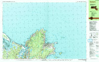
1984 Map of Rockport
USGS Topo · Published 1984About this map
Rockport and the surrounding coastline of Cape Ann are meticulously detailed in this mid-1980s study of the Massachusetts shore. The map highlights the area's granite-quarrying legacy with numerous labeled Quarry sites and a Gravel Pit scattered across the interior, while the coastal settlements of Lanesville, Pigeon Cove, and Bay View are linked by the winding shore roads. The transition from industrial utility to conservation is evident in the inclusion of the Thacher Island National Wildlife Refuge and Milk Island Wildlife Sanctuary.
Find a feature on this map
94 named features on this map. Tap any name to fly to it.
Don’t see what you’re looking for? This feature index may not catch every label — zoom into the map to look around manually.
Map Details
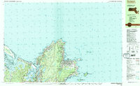
Editions of this 1984 Rockport Map
2 editions found
Other maps of this area

1886 · Gloucester
USGS Topo · 1:62,500

1888 · Newburyport
USGS Topo · 1:62,500

1888 · Gloucester
USGS Topo · 1:62,500

1888 · Salem
USGS Topo · 1:62,500

1890 · Newburyport
USGS Topo · 1:62,500

1893 · Salem
USGS Topo · 1:62,500

1893 · Gloucester
USGS Topo · 1:62,500

1894 · Newburyport
USGS Topo · 1:62,500

1917 · Salem
USGS Topo · 1:62,500

1918 · Gloucester
USGS Topo · 1:62,500