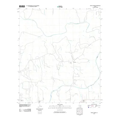
2010 Map of Rocky Creek
USGS Topo · Published 2010About this map
The Pedernales River snakes along the eastern edge of this Blanco County landscape, serving as the primary drainage for a network of seasonal and perennial streams. In the early 2010s, this area remained largely defined by large ranching tracts and rural subdivisions like Rocky Creek Ranch. The community of Post Oak serves as a local anchor, centered near the intersection of Ranch Rd 1320 and Farm Rd 2721, where the Post Oak Cemetery preserves local family histories.
Find a feature on this map
32 named features on this map. Tap any name to fly to it.
Don’t see what you’re looking for? This feature index may not catch every label — zoom into the map to look around manually.
Map Details
Editions of this 2010 Rocky Creek Map
This is the sole edition of this map. No revisions or reprints were ever made.
Other maps of this area

1887 · Blanco
USGS Topo · 1:125,000

1894 · Fredericksburg
USGS Topo · 1:125,000

1894 · Blanco
USGS Topo · 1:125,000

1954 · Llano
USGS Topo · 1:250,000

1955 · Llano
USGS Topo · 1:250,000

1956 · Llano
USGS Topo · 1:250,000

1961 · Stonewall
USGS Topo · 1:24,000

1961 · Hye
USGS Topo · 1:24,000

1961 · Cave Creek School
USGS Topo · 1:24,000

1961 · Rocky Creek
USGS Topo · 1:24,000