Loading...
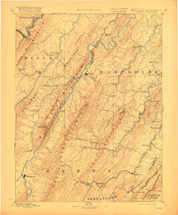
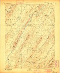
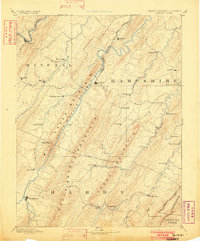
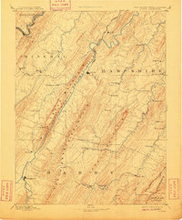
Loading map...1891 Map of Romney
USGS Topo · Published 1921About this map
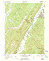
Romney serves as the focal point of this late 19th-century survey, situated at the bend of the South Branch Potomac River where it winds between the massive ridges of South Branch Mountain. This era in the Potomac Highlands is defined by a landscape of isolated valleys and early industrial pockets, such as Capon Iron Works and Adams Mill. The northern edge of the map captures the critical transportation corridor of the Baltimore and Ohio Railroad, which follows the main stem of the Potomac River through Keyser.
Find a feature on this map
66 named features on this map. Tap any name to fly to it.
Don’t see what you’re looking for? This feature index may not catch every label — zoom into the map to look around manually.
Map Details
Date Portrayed1891
Date Published1921
PublisherU.S. Geological Survey
Map TypeTopographic
Scale1:125,000
Physical Dimensions16.5 x 20 inches
Editions of this 1891 Romney Map
5 editions found

Historical Maps of Keyser Through Time
3 maps found

Featured Locations
Source Details
SourceU.S. Geological Survey
CopyrightPublic Domain