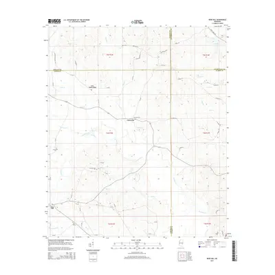
2015 Map of Rose Hill
USGS Topo · Published 2015About this map
Souenlovie Cr and its numerous tributaries, including Penantly Cr and Dry Cr, dictate the drainage of this East Mississippi landscape. The settlement of Rose Hill occupies the southwestern corner, while the central corridor is defined by the rural communities of Fellowship and New Fellowship. These small hubs serve as focal points for local genealogy, housing several burial grounds such as Fellowship Cem and Pleasant Grove Cem.
Find a feature on this map
66 named features on this map. Tap any name to fly to it.
Don’t see what you’re looking for? This feature index may not catch every label — zoom into the map to look around manually.
Map Details
Editions of this 2015 Rose Hill Map
This is the sole edition of this map. No revisions or reprints were ever made.
Other maps of this area

1953 · Meridian
USGS Topo · 1:250,000

1957 · Meridian
USGS Topo · 1:250,000

1957 · Chunky
USGS Topo · 1:62,500

1957 · Enterprise
USGS Topo · 1:62,500

1965 · Meridian
USGS Topo · 1:250,000

1966 · Hickory
USGS Topo · 1:24,000

1970 · Paulding
USGS Topo · 1:24,000

1970 · Hero
USGS Topo · 1:24,000

1982 · Meehan
USGS Topo · 1:24,000
1983 · Rose Hill
USGS Topo · 1:24,000