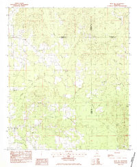
1983 Map of Rose Hill
USGS Topo · Published 1983About this map
Rose Hill and Twistwood anchor this 1980s landscape, positioned where Jasper County meets Newton, Lauderdale, and Clarke. The region is defined by a dense network of spiritual and social centers, with Hopewell Ch, New Fellowship Ch, and East Galilee Ch serving the rural population. The terrain is deeply dissected by a web of waterways, including Souenlouie Creek and Penantly Creek, which create a complex system of ridges and valleys typical of eastern Mississippi. Genealogists can locate family burial sites at the Rose Hill Cem, while the inclusion of landmarks like Wanilla Lake and numerous named branches such as Tanyard Branch and Allen Branch provides specific points for tracing local land tracts. The abundance of small community churches, such as Magnolia Ch and Pleasant Grove Ch, suggests a long-standing pattern of localized settlements centered around these institutions.
Find a feature on this map
26 named features on this map. Tap any name to fly to it.
Don’t see what you’re looking for? This feature index may not catch every label — zoom into the map to look around manually.
Map Details
Editions of this 1983 Rose Hill Map
This is the sole edition of this map. No revisions or reprints were ever made.
Other maps of this area

1953 · Meridian
USGS Topo · 1:250,000

1957 · Meridian
USGS Topo · 1:250,000

1957 · Chunky
USGS Topo · 1:62,500

1957 · Enterprise
USGS Topo · 1:62,500

1965 · Meridian
USGS Topo · 1:250,000

1966 · Hickory
USGS Topo · 1:24,000

1970 · Paulding
USGS Topo · 1:24,000

1970 · Hero
USGS Topo · 1:24,000

1982 · Meehan
USGS Topo · 1:24,000
1983 · Chunky
USGS Topo · 1:24,000