
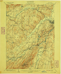
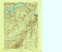
1903 Map of Rosendale
USGS Topo · Published 1903This historical map portrays the area of Rosendale in 1903, primarily covering Ulster. Featuring a scale of 1:62500, this map provides a highly detailed snapshot of the terrain, roads, buildings, counties, and historical landmarks in the Rosendale region at the time. Published in 1903, it is one of 11 known editions of this map due to revisions or reprints.
Find a feature on this map
96 named features on this map. Tap any name to fly to it.
Don’t see what you’re looking for? This feature index may not catch every label — zoom into the map to look around manually.
Map Details
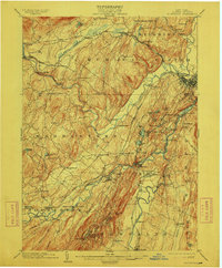
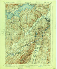
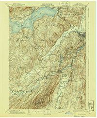
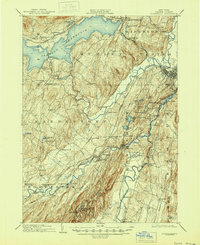
Editions of this 1903 Rosendale Map
11 editions found
1903 edition
16.6 x 20.1 inches

1906 edition
16.6 x 20 inches
1908 edition
16.6 x 20.1 inches
1912 edition
16.6 x 20 inches
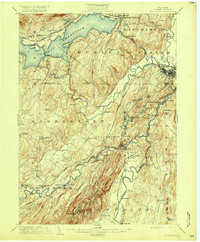
1917 edition
16.6 x 20.1 inches
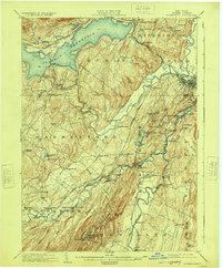
1924 edition
16.6 x 20.1 inches
1930 edition
24 x 19.9 inches
1933 edition
16.6 x 20 inches
1940 edition
16.6 x 20.1 inches
1945 edition
16.9 x 20.7 inches

1951 edition
16.9 x 20.8 inches
Historical Maps of Saint Remy Through Time
47 maps found

1901 Rosendale
Ulster County, NY

1903 Newburgh
Ulster County, NY
1903 Rosendale
Ulster County, NY

1903 Slide Mountain
Ulster County, NY

1905 Slide Mountain
Ulster County, NY

1942 Ashokan
Ulster County, NY

1942 Kingston West
Ulster County, NY

1942 Lackawack
Ulster County, NY

1942 Mohonk Lake
Ulster County, NY

1942 Rosendale
Ulster County, NY

1942 West Shokan
Ulster County, NY

1943 Ashokan
Ulster County, NY

1943 Gardiner
Ulster County, NY

1943 Kingston West
Ulster County, NY

1943 Lackawack
Ulster County, NY

1943 Mohonk Lake
Ulster County, NY

1943 Peekamoose Mountain
Ulster County, NY

1943 Rosendale
Ulster County, NY

1943 West Shokan
Ulster County, NY

1945 Arena
Ulster County, NY

1945 Bearsville
Ulster County, NY

1945 Seager
Ulster County, NY

1945 Woodstock
Ulster County, NY

1946 Arena
Ulster County, NY

1946 Bearsville
Ulster County, NY

1946 Newburgh
Ulster County, NY

1946 Plattekill
Ulster County, NY

1946 Seager
Ulster County, NY

1946 Shandaken
Ulster County, NY

1957 Gardiner
Ulster County, NY

1960 Shandaken
Ulster County, NY

1963 Saugerties
Ulster County, NY

1964 Ashokan
Ulster County, NY

1964 Kingston West
Ulster County, NY

1964 Mohonk Lake
Ulster County, NY

1964 Rosendale
Ulster County, NY

1966 Claryville
Ulster County, NY

1969 Peekamoose Mtn
Ulster County, NY

1969 Rondout Reservior
Ulster County, NY

1969 West Shokan
Ulster County, NY

1980 Kingston West
Ulster County, NY

1997 Bearsville
Ulster County, NY

1997 Kingston West
Ulster County, NY

1997 Peekamoose Mtn
Ulster County, NY

1997 Saugerties
Ulster County, NY

1997 Shandaken
Ulster County, NY

1997 West Shokan
Ulster County, NY