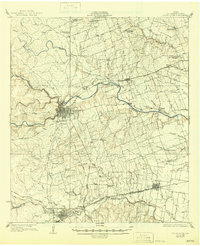
1928 Map of Round Rock
USGS Topo · Published 1945About this map
Georgetown serves as the central hub of this Central Texas landscape, situated at the confluence of the North Fork and South Fork of the San Gabriel River. The mapping, based on mid-1920s field work, reveals a rural economy organized around cotton and cattle, evidenced by industrial sites like the Bell Gin and the extensive network of country schools that anchored each rural district. Key social centers such as the Strickland Grove Church and schools like Montadale School and Ranger School appear along the drainage divides.
Find a feature on this map
50 named features on this map. Tap any name to fly to it.
Don’t see what you’re looking for? This feature index may not catch every label — zoom into the map to look around manually.
Map Details
Editions of this 1928 Round Rock Map
2 editions found

Other maps of this area

1885 · Taylor
USGS Topo · 1:125,000

1885 · Bastrop
USGS Topo · 1:125,000

1887 · Taylor
USGS Topo · 1:125,000

1893 · Georgetown
USGS Topo · 1:125,000

1893 · Bastrop
USGS Topo · 1:125,000

1894 · Taylor
USGS Topo · 1:125,000

1896 · Austin
USGS Topo · 1:125,000

1897 · Austin
USGS Topo · 1:125,000

1904 · Bastrop
USGS Topo · 1:125,000

1910 · Austin
USGS Topo · 1:125,000