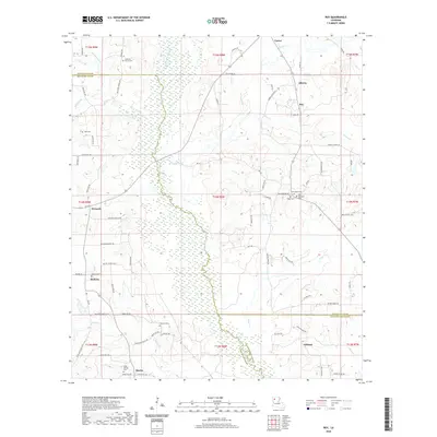
2020 Map of Roy
USGS Topo · Published 2020About this map
Black Lake Bayou creates a distinct north-south marshy corridor through this portion of northern Louisiana, marking a natural divide between the settlements of Womack and Alberta. The landscape is defined by the convergence of Red River, Bienville, and Natchitoches Parishes, where small communities like Methvin, Roy, and Martin are connected by a network of parish roads. Local history is deeply etched into the terrain through numerous family and community burial grounds, such as Cabiness Family Cem, Luke Cem, and New Hope Cem. The southern reach of the map features the village of Ashland and the Holly Springs Br drainage, illustrating the rural, creek-fed geography characteristic of the region. This 2020 edition provides a clear view of the existing road grid, including La 514 and Iron Springs Rd, alongside traditional landmarks like Bethel Church.
Find a feature on this map
124 named features on this map. Tap any name to fly to it.
Don’t see what you’re looking for? This feature index may not catch every label — zoom into the map to look around manually.
Map Details
Editions of this 2020 Roy Map
This is the sole edition of this map. No revisions or reprints were ever made.
Other maps of this area

1947 · Ringgold
USGS Topo · 1:62,500

1947 · Ashland
USGS Topo · 1:62,500

1948 · Coushatta
USGS Topo · 1:62,500

1948 · Jamestown
USGS Topo · 1:62,500

1949 · Jamestown
USGS Topo · 1:62,500

1955 · Shreveport
USGS Topo · 1:250,000

1956 · Shreveport
USGS Topo · 1:250,000

1956 · Ringgold
USGS Topo · 1:62,500
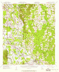
1957 · Coushatta
USGS Topo · 1:62,500

1957 · Ashland
USGS Topo · 1:62,500