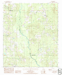
1986 Map of Roy
USGS Topo · Published 1986About this map
Black Lake Bayou and its winding tributaries define the landscape of this North Louisiana region, where the borders of Bienville, Red River, and Natchitoches Parishes converge. The map documents a network of small rural settlements including Alberta, Roy, and Womack, many of which grew around early creek crossings and local industries. The land is heavily marked by the timber and mineral extraction economy, evidenced by several Gravel Pits and a maze of unimproved roads connecting family homesteads to regional centers like Ashland.
Find a feature on this map
26 named features on this map. Tap any name to fly to it.
Don’t see what you’re looking for? This feature index may not catch every label — zoom into the map to look around manually.
Map Details
Editions of this 1986 Roy Map
This is the sole edition of this map. No revisions or reprints were ever made.
Other maps of this area

1947 · Ringgold
USGS Topo · 1:62,500

1947 · Ashland
USGS Topo · 1:62,500

1948 · Coushatta
USGS Topo · 1:62,500

1948 · Jamestown
USGS Topo · 1:62,500

1949 · Jamestown
USGS Topo · 1:62,500

1955 · Shreveport
USGS Topo · 1:250,000

1956 · Shreveport
USGS Topo · 1:250,000

1956 · Ringgold
USGS Topo · 1:62,500
1957 · Coushatta
USGS Topo · 1:62,500

1957 · Ashland
USGS Topo · 1:62,500