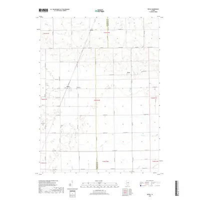
2018 Map of Royal
USGS Topo · Published 2018About this map
Royal serves as a central hub for this rural agricultural landscape where the Champaign Co Vermilion Co line defines the eastern boundary. The grid of country roads, including Co RD 20, organizes the vast farmsteads and connects the small communities of Hope and Dailey. Local genealogy is anchored by the Saint John Lutheran Cem and Stearns Cem, while the natural drainage of the prairie is visible through the winding paths of Stony Cr and Buck Cr. The presence of Railroad St in Royal suggests the historic rail-based commerce that originally established these settlements in the Illinois plains. The landscape is largely defined by precise township and range divisions, such as t20n r14w, which continue to dictate the placement of local thoroughfares and property lines.
Find a feature on this map
51 named features on this map. Tap any name to fly to it.
Don’t see what you’re looking for? This feature index may not catch every label — zoom into the map to look around manually.
Map Details
Editions of this 2018 Royal Map
This is the sole edition of this map. No revisions or reprints were ever made.
Other maps of this area

1906 · Urbana
USGS Topo · 1:62,500

1924 · Paxton
USGS Topo · 1:62,500

1927 · Paxton
USGS Topo · 1:62,500

1931 · Fithian
USGS Topo · 1:48,000

1936 · Potomac
USGS Topo · 1:62,500

1943 · Fithian
USGS Topo · 1:62,500

1949 · Paxton
USGS Topo · 1:62,500

1953 · Danville
USGS Topo · 1:250,000

1955 · Danville
USGS Topo · 1:250,000

1956 · Danville
USGS Topo · 1:250,000