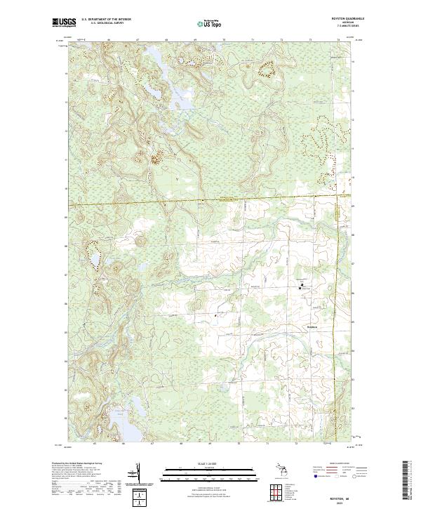
2023 Map of Royston
USGS Topo · Published 2023About this map
The North Branch Thunder Bay River meanders across this northern Michigan landscape, defining the character of the Royston vicinity. This modern topographical study reveals a network of county roads and family-named thoroughfares, such as Huntley Rd and Bismarck Rd, that connect isolated settlements and burial grounds. Genealogists can identify the locations of the Montmorency Cem and Saint Johns Cem situated near the town site. The northern reaches are characterized by numerous small bodies of water and wetlands, including Lake Ruth and the headwaters of the Ocqueoc River. Further south, the landscape is punctuated by Ribble Lake and Long Lake Pond, showing the hydrological complexity of the area where Truax Creek and Grass Creek drain through the forested terrain.
Find a feature on this map
56 named features on this map. Tap any name to fly to it.
Don’t see what you’re looking for? This feature index may not catch every label — zoom into the map to look around manually.
Map Details
Editions of this 2023 Royston Map
This is the sole edition of this map. No revisions or reprints were ever made.
Other maps of this area

1954 · Alpena
USGS Topo · 1:250,000

1955 · Atlanta
USGS Topo · 1:62,500

1955 · Hillman
USGS Topo · 1:62,500

1955 · Cheboygan
USGS Topo · 1:250,000

1957 · Alpena
USGS Topo · 1:250,000

1957 · Onaway
USGS Topo · 1:62,500

1958 · Cheboygan
USGS Topo · 1:250,000

1958 · Alpena
USGS Topo · 1:250,000

1969 · Alpena
USGS Topo · 1:250,000

1971 · Hawks
USGS Topo · 1:24,000