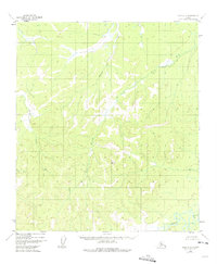
1952 Map of Ruby A-4
USGS Topo · Published 1975About this map
The Nowitna River anchors the southeastern corner of this Alaskan interior landscape, winding through a complex system of drainage basins captured during a 1952 aerial survey. The terrain is defined by a dense network of tributaries including Bonanza Creek and the Lost River, which carve through the elevations of the Ruby quadrangle. Mapping by the U.S. Geological Survey reveals a wilderness devoid of established roads or settlements at the time of photography, highlighting the importance of watercourses for navigation and geography. Features like Little Wood Creek and Moose Creek illustrate the typical naming conventions of the era, likely reflecting the local fauna and resource potential encountered by early surveyors and bush pilots in the territory.
Find a feature on this map
6 named features on this map. Tap any name to fly to it.
Don’t see what you’re looking for? This feature index may not catch every label — zoom into the map to look around manually.
Map Details
Editions of this 1952 Ruby A-4 Map
2 editions found
Other maps of this area

1950 · Medfra
USGS Topo · 1:250,000

1951 · Ruby
USGS Topo · 1:250,000

1952 · Ruby A-3
USGS Topo · 1:63,360

1952 · Ruby A-4
USGS Topo · 1:63,360

1952 · Ruby B-4
USGS Topo · 1:63,360

1952 · Ruby B-3
USGS Topo · 1:63,360

1952 · Ruby B-5
USGS Topo · 1:63,360

1952 · Ruby A-5
USGS Topo · 1:63,360

1952 · Ruby
USGS Topo · 1:250,000
1953 · Ruby B-3
USGS Topo · 1:63,360