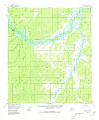
1952 Map of Ruby A-5
USGS Topo · Published 1981About this map
Sulatna Crossing and Tamarack serve as small focal points along the meandering Sulatna River during the early 1950s. This interior Alaskan landscape is defined by its drainage networks, where the river and its many tributaries, such as South Fork Sulatna River and Antoski Creek, dominate the terrain. A Winter Trail cuts across the northwest, providing a vital overland connection through the marshy lowlands and over the Sulatna Bluff. Evidence of industrial activity is present at the Strip Mine near Schist Creek, where an Aband marker indicates the shifting nature of resource extraction in the region. The map also features numerous survey markers like VABM 1420 Gold, highlighting the systematic effort to chart this territory. These named features, including Poorman Creek and Bonanza Creek, reflect a history of prospecting and seasonal transit in a remote riverine environment.
Find a feature on this map
41 named features on this map. Tap any name to fly to it.
Don’t see what you’re looking for? This feature index may not catch every label — zoom into the map to look around manually.
Map Details
Editions of this 1952 Ruby A-5 Map
3 editions found
Other maps of this area

1950 · Medfra
USGS Topo · 1:250,000

1951 · Ruby
USGS Topo · 1:250,000

1952 · Ruby A-4
USGS Topo · 1:63,360

1952 · Ruby B-6
USGS Topo · 1:63,360

1952 · Ruby B-4
USGS Topo · 1:63,360

1952 · Ruby B-5
USGS Topo · 1:63,360

1952 · Ruby A-5
USGS Topo · 1:63,360

1952 · Ruby A-6
USGS Topo · 1:63,360

1952 · Ruby
USGS Topo · 1:250,000

1954 · Medfra D-5
USGS Topo · 1:63,360