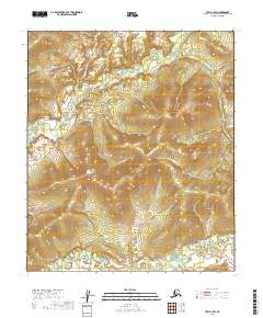
2019 Map of Ruby C-1 SW
USGS Topo · Published 2019About this map
The Big Mud River meanders across the southern reaches of this interior Alaska landscape, defining the low-lying drainage patterns of the T11s R27e and T11s R28e townships. This 2019 survey documents a vast, undeveloped expanse where the terrain rises sharply from the river basin into a series of high ridges and narrow valleys. To the north, the headwaters of Grand Cr carve through the uplands of T10s R27e, illustrating the complex topography of the Yukon-Koyukuk region. The absence of roads or permanent structures on this sheet underscores the preservation of a wilderness character nearly unchanged by modern infrastructure. Researchers can trace the natural hydrology of the river’s oxbows and the steep contour gradients that define the divide between these two primary water systems.
Find a feature on this map
6 named features on this map. Tap any name to fly to it.
Don’t see what you’re looking for? This feature index may not catch every label — zoom into the map to look around manually.
Map Details
Editions of this 2019 Ruby C-1 SW Map
This is the sole edition of this map. No revisions or reprints were ever made.
Other maps of this area

1951 · Ruby
USGS Topo · 1:250,000

1952 · Ruby B-1
USGS Topo · 1:63,360

1952 · Ruby B-2
USGS Topo · 1:63,360

1952 · Ruby C-1
USGS Topo · 1:63,360

1952 · Ruby C-2
USGS Topo · 1:63,360

1952 · Ruby
USGS Topo · 1:250,000

1964 · Ruby
USGS Topo · 1:250,000
2019 · Ruby C-1 SE
USGS Topo · 1:25,000
2019 · Ruby C-2 SE
USGS Topo · 1:25,000
2019 · Ruby B-2 NE
USGS Topo · 1:25,000