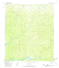
1952 Map of Ruby C-1
USGS Topo · Published 1974About this map
Big Mud River winds across the southern reaches of this interior Alaskan landscape, a region defined by extensive wetland complexes and isolated high points. Mapping conducted via aerial photography in the early 1950s reveals a wilderness predominantly shaped by drainage patterns rather than human settlement. The terrain is punctuated by several prominent surveying benchmarks, including VABM 2045 Two in the west and VABM 1923 Seven further south. These high points served as critical navigational and surveying anchors during the mid-century efforts to chart the Kateel River Meridian. The northern portion of the map is drained by Grand Creek, which meanders through a dense network of small lakes and ponds, illustrating the typical permafrost-influenced hydrology of the Yukon-Koyukuk region before any modern infrastructure reached this sector.
Find a feature on this map
7 named features on this map. Tap any name to fly to it.
Don’t see what you’re looking for? This feature index may not catch every label — zoom into the map to look around manually.
Map Details
Editions of this 1952 Ruby C-1 Map
2 editions found
Other maps of this area

1948 · Kantishna River
USGS Topo · 1:250,000

1951 · Kantishna River
USGS Topo · 1:250,000

1951 · Ruby
USGS Topo · 1:250,000

1952 · Ruby B-1
USGS Topo · 1:63,360

1952 · Ruby B-2
USGS Topo · 1:63,360

1952 · Ruby C-1
USGS Topo · 1:63,360

1952 · Kantishna River C-6
USGS Topo · 1:63,360

1952 · Ruby D-1
USGS Topo · 1:63,360

1952 · Ruby C-2
USGS Topo · 1:63,360

1952 · Kantishna River
USGS Topo · 1:250,000