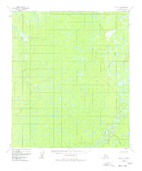
1952 Map of Ruby C-4
USGS Topo · Published 1978About this map
The Nowitna River meanders through this interior Alaska landscape, creating a complex network of oxbow lakes and abandoned channels that define the eastern edge of the quadrangle. Photogrammetric methods from 1952 capture a vast expanse of wetlands and low-relief terrain, where drainage patterns are dictated by subtle shifts in elevation. The Sulatna River joins the southern drainage system, while Big Creek and Monzonite Creek flow through areas of dense marshland. This survey reflects the region's character before modern infrastructure reached deep into the Yukon-Koyukuk area, showing land lines predetermined by the Bureau of Land Management under the Kateel River Meridian. The absence of roads or trails highlights the reliance on waterways like Smith Slough for navigation through this wilderness during the mid-twentieth century.
Find a feature on this map
5 named features on this map. Tap any name to fly to it.
Don’t see what you’re looking for? This feature index may not catch every label — zoom into the map to look around manually.
Map Details
Editions of this 1952 Ruby C-4 Map
2 editions found
Other maps of this area

1951 · Ruby
USGS Topo · 1:250,000

1952 · Ruby D-4
USGS Topo · 1:63,360

1952 · Ruby D-5
USGS Topo · 1:63,360

1952 · Ruby C-3
USGS Topo · 1:63,360

1952 · Ruby B-4
USGS Topo · 1:63,360

1952 · Ruby C-5
USGS Topo · 1:63,360

1952 · Ruby B-3
USGS Topo · 1:63,360

1952 · Ruby B-5
USGS Topo · 1:63,360

1952 · Ruby D-3
USGS Topo · 1:63,360

1952 · Ruby C-4
USGS Topo · 1:63,360