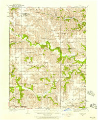
1935 Map of Russell
USGS Topo · Published 1958About this map
The Chariton River and its many winding tributaries, including South Fork Chariton River and Goodwater Creek, dictate the geography of this rural landscape during the mid-1930s. The region is densely populated with small agrarian hubs and educational landmarks, as evidenced by the high concentration of named schools like Brush College Sch and Maple Grove Sch scattered across the townships. The Chicago Burlington and Quincy RR provides a critical northern transit corridor through the towns of Russell and Melrose.
Find a feature on this map
80 named features on this map. Tap any name to fly to it.
Don’t see what you’re looking for? This feature index may not catch every label — zoom into the map to look around manually.
Map Details
Editions of this 1935 Russell Map
2 editions found
Other maps of this area

1918 · Chariton
USGS Topo · 1:62,500

1924 · Melcher
USGS Topo · 1:62,500

1929 · Albia
USGS Topo · 1:62,500

1934 · Humeston
USGS Topo · 1:48,000

1935 · Russell
USGS Topo · 1:62,500

1937 · Corydon
USGS Topo · 1:62,500

1938 · Russell
USGS Topo · 1:62,500

1939 · Centerville
USGS Topo · 1:62,500

1939 · Mystic
USGS Topo · 1:62,500

1941 · Centerville
USGS Topo · 1:62,500