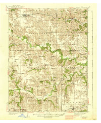
1938 Map of Russell
USGS Topo · Published 1938About this map
Russell and Melrose serve as the primary rail hubs along the Chicago Burlington and Quincy railroad, which cuts across the northern landscape of southern Iowa. The terrain is defined by the winding course of the Chariton River and its numerous tributaries, including Honey Creek and the South Fork Chariton River. This 1930s survey reveals an incredibly dense network of rural infrastructure, where nearly every section of land is served by a local schoolhouse.
Find a feature on this map
65 named features on this map. Tap any name to fly to it.
Don’t see what you’re looking for? This feature index may not catch every label — zoom into the map to look around manually.
Map Details
Editions of this 1938 Russell Map
2 editions found
Other maps of this area

1918 · Chariton
USGS Topo · 1:62,500

1924 · Melcher
USGS Topo · 1:62,500

1929 · Albia
USGS Topo · 1:62,500

1934 · Humeston
USGS Topo · 1:48,000

1935 · Russell
USGS Topo · 1:62,500

1937 · Corydon
USGS Topo · 1:62,500

1938 · Russell
USGS Topo · 1:62,500

1939 · Centerville
USGS Topo · 1:62,500

1939 · Mystic
USGS Topo · 1:62,500

1941 · Centerville
USGS Topo · 1:62,500