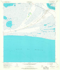
1957 Map of Sabine Pass
USGS Topo · Published 1968About this map
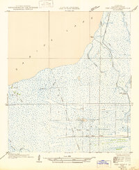
Sabine Pass serves as a critical coastal gateway where the Texas and Louisiana borders meet at the edge of the Gulf of Mexico. This mid-century survey captures the industrial and maritime character of Jefferson County, where oil tanks and a prominent Radio Tower stand near the settlement of Sabine Pass. The landscape is dominated by a complex network of brackish water bodies, including Keith Lake, Knight Lake, and Salt Lake, separated by low-lying features like Wildcat Ridge.
Find a feature on this map
23 named features on this map. Tap any name to fly to it.
Don’t see what you’re looking for? This feature index may not catch every label — zoom into the map to look around manually.
Map Details
Editions of this 1957 Sabine Pass Map
Other maps of this area

1932 · Sabine Pass NE
USGS Topo · 1:31,680

1943 · West of Johnson Bayou
USGS Topo · 1:24,000

1943 · Port Arthur South
USGS Topo · 1:24,000

1944 · Sabine Pass
USGS Topo · 1:31,680

1944 · Texas Point
USGS Topo · 1:31,680
1946 · Sabine Pass NE
USGS Topo · 1:31,680
1946 · Port Arthur SE
USGS Topo · 1:31,680

1950 · Houston
USGS Topo · 1:250,000

1954 · Port Arthur
USGS Topo · 1:250,000

1956 · Houston
USGS Topo · 1:250,000