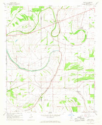
1967 Map of Sabino
USGS Topo · Published 1968About this map
The low-lying Yazoo-Mississippi Delta landscape dominates this mid-century survey of the Coahoma and Quitman county line. The meandering courses of Cassidy Bayou and Oxbow Bayou define the drainage patterns of the area, punctuated by stagnant water bodies like Deadwater and Lost Lake. This region is characterized by a high density of small rural congregations and cemeteries, providing an essential record for genealogists. Landmarks such as Smith Chapel, Macedonia Ch, and the Anderson Chapel Cemetery are spread across the alluvial plain, often adjacent to family-named landmarks like the Indian Mound near the western border. Small agricultural centers such as Sabino and Walnut are linked by a network of unimproved roads and drainage projects, including a Siphon and a Gaging Station, illustrating the ongoing human efforts to manage the water-rich bottomlands for cultivation.
Find a feature on this map
32 named features on this map. Tap any name to fly to it.
Don’t see what you’re looking for? This feature index may not catch every label — zoom into the map to look around manually.
Map Details
Editions of this 1967 Sabino Map
2 editions found
Other maps of this area

1908 · Coahoma
USGS Topo · 1:24,000

1908 · Jonestown
USGS Topo · 1:24,000

1910 · Coahoma
USGS Topo · 1:31,680

1910 · Jonestown
USGS Topo · 1:31,680

1932 · Tutwiler
USGS Topo · 1:48,000

1932 · Marks
USGS Topo · 1:48,000

1935 · Clarksdale
USGS Topo · 1:62,500

1935 · Marks
USGS Topo · 1:62,500

1935 · Tutwiler
USGS Topo · 1:62,500

1939 · Farrell
USGS Topo · 1:62,500