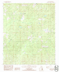
1986 Map of Sailes
USGS Topo · Published 1986About this map
Mt. Lebanon and Bryceland anchor the northeastern corner of this North Louisiana landscape as it appeared in the mid-1980s. The region is characterized by a network of rural settlements connected by winding roads through wooded terrain, with Pleasant Hill and Sailes serving as smaller community hubs. Industrial activity is evident through the presence of several Gravel Pits, while the hydrology of the area is defined by the headwaters of Brushy Creek, Pea Vine Creek, and Kepler Creek. Researchers will find numerous Cem markers scattered across the township lines, providing valuable data points for genealogical study. The map captures the quiet, upland character of Bienville Parish, where the traditional settlement patterns of the late 20th century remained intact before further modern development.
Find a feature on this map
12 named features on this map. Tap any name to fly to it.
Don’t see what you’re looking for? This feature index may not catch every label — zoom into the map to look around manually.
Map Details
Editions of this 1986 Sailes Map
This is the sole edition of this map. No revisions or reprints were ever made.
Other maps of this area

1947 · Bienville
USGS Topo · 1:62,500

1948 · Jamestown
USGS Topo · 1:62,500

1949 · Jamestown
USGS Topo · 1:62,500

1949 · Bienville
USGS Topo · 1:62,500

1949 · Gibsland
USGS Topo · 1:62,500

1950 · Gibsland
USGS Topo · 1:62,500

1950 · Arcadia
USGS Topo · 1:62,500

1951 · Arcadia
USGS Topo · 1:62,500

1955 · Shreveport
USGS Topo · 1:250,000

1956 · Shreveport
USGS Topo · 1:250,000