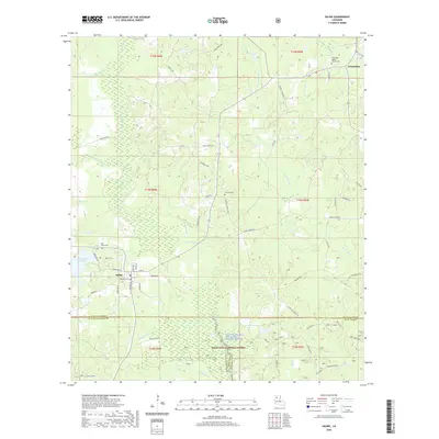
2020 Map of Saline
USGS Topo · Published 2020About this map
Saline serves as the primary hub in this portion of Bienville Parish, where the local landscape is defined by the winding course of the Saline Bayou. The waterway is distinguished here as the Saline Bayou Wild and Scenic River, protected within the northern reaches of the Kisatchie National Forest. A network of rural routes such as Loggers Loop and Bums Rd spiderweb through the piney woods, reflecting the area's long-standing connection to the timber industry. To the north, the settlement of Friendship remains a focal point for the community, centered around the Friendship Baptist Church Cem. The map provides significant detail for genealogists, marking several local burial sites including Carolina Cem, Mill Creek Cem, and Magnolia Cem, alongside numerous creek systems like Blooms Mill Cr and Sprguis Mill Cr that historically powered local industry.
Find a feature on this map
74 named features on this map. Tap any name to fly to it.
Don’t see what you’re looking for? This feature index may not catch every label — zoom into the map to look around manually.
Map Details
Editions of this 2020 Saline Map
This is the sole edition of this map. No revisions or reprints were ever made.
Other maps of this area

1947 · Goldonna
USGS Topo · 1:62,500

1947 · Ashland
USGS Topo · 1:62,500

1947 · Bienville
USGS Topo · 1:62,500

1948 · Jamestown
USGS Topo · 1:62,500

1949 · Jamestown
USGS Topo · 1:62,500

1949 · Bienville
USGS Topo · 1:62,500

1955 · Shreveport
USGS Topo · 1:250,000

1956 · Shreveport
USGS Topo · 1:250,000

1957 · Goldonna
USGS Topo · 1:62,500

1957 · Ashland
USGS Topo · 1:62,500