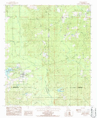
1986 Map of Saline
USGS Topo · Published 1986About this map
Saline sits at the heart of this landscape, where the confluence of several mill-named watercourses reflects a history of local industry. The village is surrounded by an intricate drainage system including Blooms Mill Creek, Sprawls Mill Creek, and Mill Creek, the latter feeding into the prominent Mill Creek Reservoir. To the north, the community of Friendship is marked by the Lookout Tower Friendship, a vital landmark for the surrounding timberlands of the Kisatchie National Forest.
Find a feature on this map
26 named features on this map. Tap any name to fly to it.
Don’t see what you’re looking for? This feature index may not catch every label — zoom into the map to look around manually.
Map Details
Editions of this 1986 Saline Map
This is the sole edition of this map. No revisions or reprints were ever made.
Other maps of this area

1947 · Goldonna
USGS Topo · 1:62,500

1947 · Ashland
USGS Topo · 1:62,500

1947 · Bienville
USGS Topo · 1:62,500

1948 · Jamestown
USGS Topo · 1:62,500

1949 · Jamestown
USGS Topo · 1:62,500

1949 · Bienville
USGS Topo · 1:62,500

1955 · Shreveport
USGS Topo · 1:250,000

1956 · Shreveport
USGS Topo · 1:250,000

1957 · Goldonna
USGS Topo · 1:62,500

1957 · Ashland
USGS Topo · 1:62,500