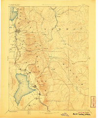
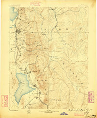
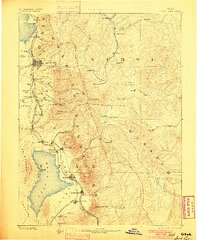
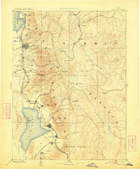
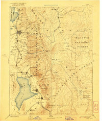
1885 Map of Salt Lake
USGS Topo · Published 1906About this map
The Wasatch Mountains dominate this late nineteenth-century reconnaissance, framing the growing corridor of settlement between the Great Salt Lake and Utah Lake. The map reveals an early industrial landscape where mining and agriculture met, centered on the newly established city grid of Salt Lake City and the military outpost at Fort Douglass. Mountain peaks like Timpanogos Peak and Lone Peak rise above the canyons that provided water and transit routes for the era's emerging towns.
Find a feature on this map
81 named features on this map. Tap any name to fly to it.
Don’t see what you’re looking for? This feature index may not catch every label — zoom into the map to look around manually.
Map Details
Editions of this 1885 Salt Lake Map
7 editions found

Other maps of this area

1885 · Salt Lake
USGS Topo · 1:250,000

1885 · Manti
USGS Topo · 1:250,000

1885 · Sevier Desert
USGS Topo · 1:250,000

1885 · Uinta
USGS Topo · 1:250,000

1885 · Tooele Valley
USGS Topo · 1:250,000

1886 · Price River
USGS Topo · 1:250,000

1895 · Manti
USGS Topo · 1:250,000

1896 · Price River
USGS Topo · 1:250,000

1900 · Coalville
USGS Topo · 1:125,000
1901 · Hayden Peak
USGS Topo · 1:125,000