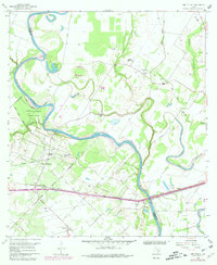
1960 Map of San Felipe
USGS Topo · Published 1980About this map
The Brazos River meanders sharply through this 1960 landscape, defining the border between Austin and Waller counties and anchoring the historic settlement of San Felipe. The town's historical significance is preserved at Stephen F Austin State Park, while the surrounding rural landscape is dotted with family and community landmarks essential for genealogical research. Small church communities like Wesley Chapel, Williams Chapel, and Downeys Chapel are interspersed with several burial grounds, including Rosses Cem, Clemons Cem, and Waller Cem.
Find a feature on this map
38 named features on this map. Tap any name to fly to it.
Don’t see what you’re looking for? This feature index may not catch every label — zoom into the map to look around manually.
Map Details
Editions of this 1960 San Felipe Map
5 editions found
Other maps of this area

1950 · Houston
USGS Topo · 1:250,000

1953 · Seguin
USGS Topo · 1:250,000

1955 · Brookshire
USGS Topo · 1:62,500

1955 · Richmond
USGS Topo · 1:62,500

1956 · Sealy
USGS Topo · 1:62,500

1956 · Wallis
USGS Topo · 1:62,500

1956 · Houston
USGS Topo · 1:250,000

1958 · Seguin
USGS Topo · 1:250,000

1960 · Wallis
USGS Topo · 1:24,000

1960 · San Felipe
USGS Topo · 1:24,000