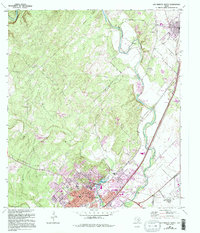
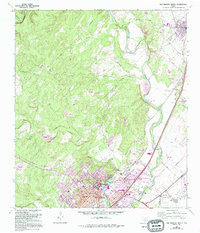
1964 Map of San Marcos North
USGS Topo · Published 1994About this map
The Blanco River and San Marcos River anchor this mid-century survey of the corridor between the growing city of San Marcos and the town of Kyle. The map captures a period of institutional and educational expansion, featuring the campus of Southwest Texas State University and the San Marcos Baptist Academy. Cultural and genealogical history is well-preserved through several landmarks, including the San Marcos Cem, Kyle Cem, and the Guadalupe Cem near the Hays and Caldwell county line.
Find a feature on this map
38 named features on this map. Tap any name to fly to it.
Don’t see what you’re looking for? This feature index may not catch every label — zoom into the map to look around manually.
Map Details
Editions of this 1964 San Marcos North Map
5 editions found
Other maps of this area

1887 · Blanco
USGS Topo · 1:125,000

1894 · Blanco
USGS Topo · 1:125,000

1896 · Austin
USGS Topo · 1:125,000

1897 · Austin
USGS Topo · 1:125,000

1910 · Austin
USGS Topo · 1:125,000

1911 · San Marcos
USGS Topo · 1:125,000

1919 · San Marcos
USGS Topo · 1:125,000

1929 · Hunter
USGS Topo · 1:62,500

1953 · Seguin
USGS Topo · 1:250,000

1954 · Llano
USGS Topo · 1:250,000