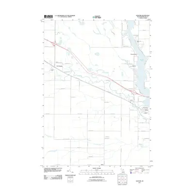
2011 Map of Sanford
USGS Topo · Published 2011About this map
Sanford Lake and the Tittabawassee River dominate the eastern edge of this Midland County landscape, serving as a focal point for the village of Sanford. The map documents a transition in transportation history, where the former rail corridor has been repurposed as the Pere Marquette Rail Trl, passing through North Bradley and continuing southeast toward the lake. This recreational infrastructure is complemented by the Sanford Lake Marina and the Black Creek Forest Campground. Local history is anchored by several burial grounds, including the Jerome Township Cemetery and Geneva Community Cemetery. The terrain is defined by a network of watercourses like Bluff Creek, Mud Creek, and Salt River that converge as they approach the primary river system, illustrating the drainage patterns that shaped early settlement in this part of Michigan.
Find a feature on this map
70 named features on this map. Tap any name to fly to it.
Don’t see what you’re looking for? This feature index may not catch every label — zoom into the map to look around manually.
Map Details
Editions of this 2011 Sanford Map
This is the sole edition of this map. No revisions or reprints were ever made.
Other maps of this area

1930 · Shepherd
USGS Topo · 1:48,000

1934 · Sanford
USGS Topo · 1:62,500

1936 · Shepherd
USGS Topo · 1:62,500

1936 · Sanford
USGS Topo · 1:62,500

1954 · Midland
USGS Topo · 1:250,000

1958 · Midland
USGS Topo · 1:250,000

1959 · Midland
USGS Topo · 1:250,000

1966 · Midland
USGS Topo · 1:250,000

1969 · Coleman
USGS Topo · 1:24,000
1969 · Hope
USGS Topo · 1:24,000