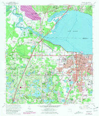
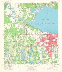
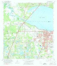
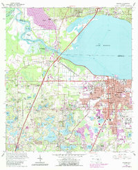
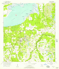
1965 Map of Sanford
USGS Topo · Published 1981About this map
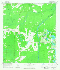
The St Johns River and Lake Monroe dominate this mid-century survey, defining the industrial and residential development of Sanford. The city’s historic fabric is visible through its diverse neighborhoods, from Highland Park and Sanlanta to the northern edge of the Seaboard Coast Line railroad. This map captures the transition of the region's economy, showing the Sanford Airport and the Sanford Naval Academy alongside older landmarks like the Courthouse and Goldsboro Sch.
Find a feature on this map
103 named features on this map. Tap any name to fly to it.
Don’t see what you’re looking for? This feature index may not catch every label — zoom into the map to look around manually.
Map Details
Editions of this 1965 Sanford Map
5 editions found

Other maps of this area

1955 · Orlando
USGS Topo · 1:250,000
1956 · Oviedo
USGS Topo · 1:24,000

1957 · Orlando
USGS Topo · 1:250,000

1958 · Orlando
USGS Topo · 1:250,000
1959 · Forest City
USGS Topo · 1:24,000

1962 · Orlando
USGS Topo · 1:250,000

1962 · Pine Lakes
USGS Topo · 1:24,000
1962 · Casselberry
USGS Topo · 1:24,000
1964 · Orange City
USGS Topo · 1:24,000
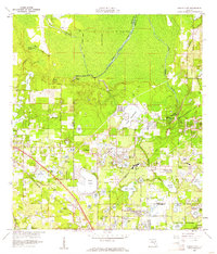
1965 · Sanford SW
USGS Topo · 1:24,000