
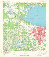
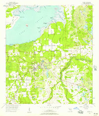
1965 Map of Sanford
USGS Topo · Published 1988About this map
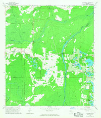
Sanford anchors the southern shore of Lake Monroe, serving as a central hub where the St Johns River and numerous rail lines converged in the mid-1960s. The urban grid extends from the waterfront down to 27th St, featuring significant community institutions like the Sanford Naval Academy and All Souls Ch. The map reveals the distinct residential patterns of the era, including the historic neighborhood of Goldsboro and the settlement of Bookertown.
Find a feature on this map
103 named features on this map. Tap any name to fly to it.
Don’t see what you’re looking for? This feature index may not catch every label — zoom into the map to look around manually.
Map Details
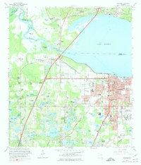
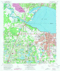
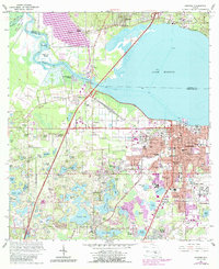
Editions of this 1965 Sanford Map
5 editions found
Other maps of this area

1955 · Orlando
USGS Topo · 1:250,000
1956 · Oviedo
USGS Topo · 1:24,000

1957 · Orlando
USGS Topo · 1:250,000

1958 · Orlando
USGS Topo · 1:250,000
1959 · Forest City
USGS Topo · 1:24,000

1962 · Orlando
USGS Topo · 1:250,000

1962 · Pine Lakes
USGS Topo · 1:24,000
1962 · Casselberry
USGS Topo · 1:24,000
1964 · Orange City
USGS Topo · 1:24,000
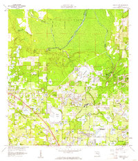
1965 · Sanford SW
USGS Topo · 1:24,000