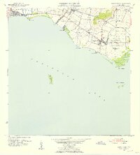
1952 Map of Santa Isabel
USGS Topo · Published 1953About this map
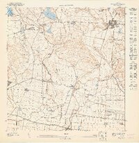
Sugarcane production and coastal transport define this southern Puerto Rican landscape, where the Ponce and Guayama railroad links inland agricultural estates to the Caribbean coast. The municipal center of Santa Isabel serves as a hub for the surrounding barrios, supported by the Estación Santa Isabel and the nearby Aeropuerto de Santa Isabel. The map documents a transition from traditional plantation life to modern industrialization, centered around the Central Cortada sugar mill and various agricultural colonies such as Colonia Hawaii and Colonia Bizarreta. Along the shoreline, fishing and maritime activity are evident at Playa Cortada and Playa Santa Isabel, while the offshore island of Cayo Berberia sits in the open waters. Named estates like Hacienda Florida and Hacienda Alomar illustrate the enduring presence of long-established landholdings in this fertile coastal plain.
Find a feature on this map
38 named features on this map. Tap any name to fly to it.
Don’t see what you’re looking for? This feature index may not catch every label — zoom into the map to look around manually.
Map Details
Editions of this 1952 Santa Isabel Map
2 editions found
Other maps of this area

1944 · Santa Isabel
USGS Topo · 1:30,000

1945 · Playa De Ponce
USGS Topo · 1:30,000

1945 · Ponce
USGS Topo · 1:30,000

1945 · Rio Descalabrado
USGS Topo · 1:30,000

1945 · Salinas
USGS Topo · 1:30,000

1946 · Coamo
USGS Topo · 1:30,000
1947 · Rio Descalabrado SE
USGS Topo · 1:10,000
1947 · Playa De Ponce NE
USGS Topo · 1:10,000
1947 · Ponce SE
USGS Topo · 1:10,000
1947 · Santa Isabel NO
USGS Topo · 1:10,000