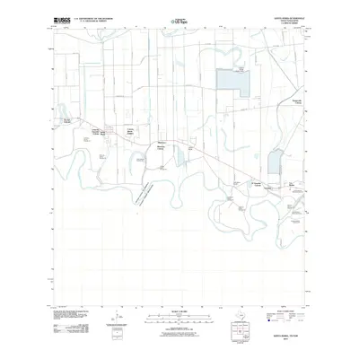
2010 Map of Santa Maria
USGS Topo · Published 2010About this map
The Rio Grande carves a complex, winding southern boundary for this region of the Lower Rio Grande Valley, defining a landscape of historical bancos and international borders. The area is characterized by a dense network of irrigation infrastructure essential to South Texas agriculture, including the Santa Maria Main Canal, La Feria Main Canal, and the Adams-Gardens Main Canal. This water management system supports diverse settlements ranging from established towns like Santa Maria and Bluetown to numerous colonias and ranching properties such as Galveston Ranch and Gloria Ranch. The map captures the unique geographic artifacts of the river's shifting course, documented through numbered land tracts like Palma Banco Number 25 and Soliseno Banco Number 23. To the north, the Arroyo Colorado provides a secondary waterway, while the Adams Winter Garden Dam highlights the era's sophisticated local water control.
Find a feature on this map
57 named features on this map. Tap any name to fly to it.
Don’t see what you’re looking for? This feature index may not catch every label — zoom into the map to look around manually.
Map Details
Editions of this 2010 Santa Maria Map
This is the sole edition of this map. No revisions or reprints were ever made.
Other maps of this area

1929 · Harlingen
USGS Topo · 1:24,000

1929 · Santa Maria
USGS Topo · 1:24,000

1929 · La Feria
USGS Topo · 1:24,000

1929 · La Paloma
USGS Topo · 1:24,000

1932 · Harlingen
USGS Topo · 1:31,680

1936 · La Feria
USGS Topo · 1:31,680

1936 · Santa Maria
USGS Topo · 1:31,680
1936 · La Paloma
USGS Topo · 1:31,680

1953 · Brownsville
USGS Topo · 1:250,000
1956 · La Paloma
USGS Topo · 1:24,000