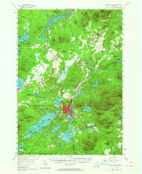
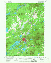
1955 Map of Saranac Lake
USGS Topo · Published 1964About this map
Saranac Lake sits as the central hub of this mid-century survey, surrounded by the intricate waterways and peaks of the Adirondack State Park. The landscape is defined by the New York Central Railroad, which facilitates movement between the settlement at Lake Clear Junction and the larger village. This era shows a community rooted in its institutions, featuring the Sanatorium at Gabriels and specialized schools like the Eight Square Sch.
Find a feature on this map
124 named features on this map. Tap any name to fly to it.
Don’t see what you’re looking for? This feature index may not catch every label — zoom into the map to look around manually.
Map Details
Editions of this 1955 Saranac Lake Map
5 editions found
Other maps of this area

1895 · Mt. Marcy
USGS Topo · 1:62,500

1896 · Lake Placid
USGS Topo · 1:62,500

1898 · Lake Placid
USGS Topo · 1:62,500

1902 · Mt. Marcy
USGS Topo · 1:62,500

1902 · Saranac
USGS Topo · 1:62,500

1904 · Saranac
USGS Topo · 1:62,500

1904 · Santanoni
USGS Topo · 1:62,500

1904 · Long Lake
USGS Topo · 1:62,500

1905 · Saint Regis
USGS Topo · 1:62,500

1906 · Loon Lake
USGS Topo · 1:62,500