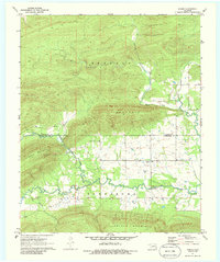
1971 Map of Sardis
USGS Topo · Published 1986About this map
Sardis serves as a central hub in this early 1970s survey, situated where the Latimer Co and Pushmataha County line divides the valley floor. The map documents a landscape defined by industrial extraction and rural community life, featuring an Asphalt Pit and Asphalt Pits near the settlement, suggesting the area's geological utility. Local history is preserved through scattered family and community sites, including Borden Cem, Anderson Cem, and Mission Ch.
Find a feature on this map
19 named features on this map. Tap any name to fly to it.
Don’t see what you’re looking for? This feature index may not catch every label — zoom into the map to look around manually.
Map Details
Editions of this 1971 Sardis Map
2 editions found
Other maps of this area

1898 · McAlester
USGS Topo · 1:125,000

1901 · Tuskahoma
USGS Topo · 1:125,000

1908 · Tuskahoma
USGS Topo · 1:125,000

1909 · Mc Alester
USGS Topo · 1:125,000

1909 · Tuskahoma
USGS Topo · 1:125,000

1950 · Mcalester
USGS Topo · 1:250,000

1962 · McAlester
USGS Topo · 1:250,000

1965 · McAlester
USGS Topo · 1:250,000

1967 · Hartshorne
USGS Topo · 1:24,000

1971 · Yanush
USGS Topo · 1:24,000