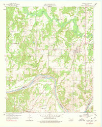
1958 Map of Sasakwa
USGS Topo · Published 1978About this map
The Canadian River and Little River carve through this landscape at the intersection of Seminole and Pontotoc Counties, where the St Louis San Francisco railroad anchors the settlement of Sasakwa. The map records a complex cultural geography, notably tracing the Approximate Old Indian Boundary that once divided tribal territories.
Find a feature on this map
40 named features on this map. Tap any name to fly to it.
Don’t see what you’re looking for? This feature index may not catch every label — zoom into the map to look around manually.
Map Details
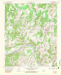
Editions of this 1958 Sasakwa Map
3 editions found
Other maps of this area

1896 · Seminole and Prague
USGS Topo · 1:125,000

1896 · Coalgate
USGS Topo · 1:125,000

1899 · Coalgate
USGS Topo · 1:125,000

1900 · Wewoka
USGS Topo · 1:125,000

1900 · Coalgate
USGS Topo · 1:125,000

1901 · Stonewall
USGS Topo · 1:125,000

1954 · Oklahoma City
USGS Topo · 1:250,000

1957 · Ardmore
USGS Topo · 1:250,000

1957 · Oklahoma City
USGS Topo · 1:250,000

1958 · Sasakwa
USGS Topo · 1:24,000