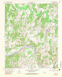
1958 Map of Sasakwa
USGS Topo · Published 1983About this map
The Approximate Old Indian Boundary cuts through this landscape where the Canadian River separates Seminole and Pontotoc counties. In the late 1950s, the region was characterized by its scattered cemeteries and rural institutions, including the Old Mission Cem, Tiger Cem, and Harjo Cem. The industrial footprint of the era is clearly visible through numerous Oil Wells and a defined Oil Field surrounding the town of Sasakwa.
Find a feature on this map
46 named features on this map. Tap any name to fly to it.
Don’t see what you’re looking for? This feature index may not catch every label — zoom into the map to look around manually.
Map Details
Editions of this 1958 Sasakwa Map
3 editions found
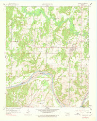
Other maps of this area

1896 · Seminole and Prague
USGS Topo · 1:125,000

1896 · Coalgate
USGS Topo · 1:125,000

1899 · Coalgate
USGS Topo · 1:125,000

1900 · Wewoka
USGS Topo · 1:125,000

1900 · Coalgate
USGS Topo · 1:125,000

1901 · Stonewall
USGS Topo · 1:125,000

1954 · Oklahoma City
USGS Topo · 1:250,000

1957 · Ardmore
USGS Topo · 1:250,000

1957 · Oklahoma City
USGS Topo · 1:250,000

1958 · Sasakwa
USGS Topo · 1:24,000