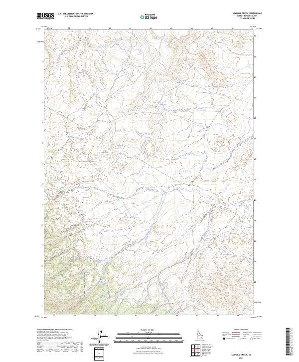
2023 Map of Sawmill Creek
USGS Topo · Published 2023About this map
The Deep Creek Mountains dominate this western Idaho landscape, defined by a complex network of seasonal drainages and named springs. Moving through the center of the sheet, the Sawmill Creek Rd follows the winding path of Sawmill Creek, while the Moonshine Trl provides historical access through the northern ridges. This 2023 survey illustrates the rugged drainage patterns of the region, from the headwaters of Moonshine Creek and Tonampi Naokwaide Creek to the narrow confines of Porcupine Canyon and Swede Canyon. Key water sources such as Fisher Spring, Sawmill Spring, and Corral Spring mark vital points in an otherwise arid terrain, highlighting the importance of localized water features for resource management and navigation in Power County.
Find a feature on this map
22 named features on this map. Tap any name to fly to it.
Don’t see what you’re looking for? This feature index may not catch every label — zoom into the map to look around manually.
Map Details
Editions of this 2023 Sawmill Creek Map
2 editions found
Other maps of this area

1934 · American Falls
USGS Topo · 1:62,500

1934 · Michaud
USGS Topo · 1:62,500

1934 · Rockland
USGS Topo · 1:62,500

1936 · American Falls
USGS Topo · 1:62,500

1937 · Rockland
USGS Topo · 1:62,500

1937 · Michaud
USGS Topo · 1:62,500

1938 · Pauline
USGS Topo · 1:48,000

1944 · Arbon
USGS Topo · 1:62,500

1954 · Pocatello
USGS Topo · 1:250,000

1958 · Pocatello
USGS Topo · 1:250,000