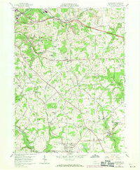
1958 Map of Saxonburg
USGS Topo · Published 1970About this map
Industrial strip mines and gas wells dot the landscape of Butler County in this mid-century topographic record, showing a region where heavy industry and rural settlement coexisted. The rail infrastructure is particularly prominent, with the Bessemer and Lake Erie, Baltimore and Ohio, and Penn Central lines cutting through the terrain to serve the various mining operations near East Butler and Wadsworth.
Find a feature on this map
55 named features on this map. Tap any name to fly to it.
Don’t see what you’re looking for? This feature index may not catch every label — zoom into the map to look around manually.
Map Details
Editions of this 1958 Saxonburg Map
4 editions found
Other maps of this area

1900 · Kittanning
USGS Topo · 1:62,500

1902 · Kittanning
USGS Topo · 1:62,500

1907 · Freeport
USGS Topo · 1:62,500

1908 · New Kensington
USGS Topo · 1:62,500

1909 · Freeport
USGS Topo · 1:62,500

1909 · Butler
USGS Topo · 1:62,500

1910 · New Kensington
USGS Topo · 1:62,500

1911 · Butler
USGS Topo · 1:62,500

1950 · Valencia
USGS Topo · 1:24,000

1953 · Pittsburgh
USGS Topo · 1:250,000