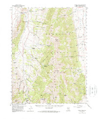
1959 Map of Schell Peaks
USGS Topo · Published 1970About this map
The high ridges of the Humboldt National Forest dominate this 1950s survey, defined by the towering summits of North Schell Peak and South Schell Peak. The landscape is a study in verticality, where deep drainages like Worthington Canyon and Ostergard Canyon carve through the Duck Creek Range toward the broad expanse of Spring Valley. Human activity is clustered around the precious water sources and mountain passes, including a Fish Hatchery near Duck Creek and several organized retreats such as the Girl Scout Camp and Camp Success (Boy Scout).
Find a feature on this map
63 named features on this map. Tap any name to fly to it.
Don’t see what you’re looking for? This feature index may not catch every label — zoom into the map to look around manually.
Map Details
Editions of this 1959 Schell Peaks Map
3 editions found

Other maps of this area

1952 · Ely
USGS Topo · 1:125,000

1956 · Ely
USGS Topo · 1:250,000

1958 · McGill
USGS Topo · 1:24,000

1958 · East Ely
USGS Topo · 1:24,000

1958 · Comins Lake
USGS Topo · 1:24,000

1958 · Ely
USGS Topo · 1:62,500

1958 · McGill
USGS Topo · 1:62,500

1959 · Ely
USGS Topo · 1:250,000

1959 · Sacramento Pass
USGS Topo · 1:62,500

1959 · Connors Pass
USGS Topo · 1:62,500