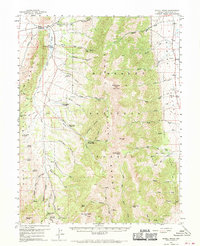
1959 Map of Schell Peaks
USGS Topo · Published 1970About this map
The Schell Creek Range dominates this mid-century topographic study, standing between Steptoe Valley to the west and Spring Valley to the east. This era of land management is represented by several recreation and service sites, including the Berry Creek Guard Sta, Berry Creek Forest Camp, and both a Girl Scout Camp and the Camp Success (Boy Scout) camp. The presence of a Fish Hatchery along Duck Creek and a Landing Strip in the eastern flats suggests a landscape utilized for both resource management and remote accessibility. High-altitude markers like North Schell Peak and South Schell Peak anchor the central ridge, while the Success Mine and various jeep trails indicate a history of mineral exploration and rugged traversal. Water sources are meticulously noted, ranging from Gallagher Spring in the north to the North Master Spring in the south, providing a detailed record of the drainage patterns through canyons like Ostergard Canyon and Water Canyon.
Find a feature on this map
67 named features on this map. Tap any name to fly to it.
Don’t see what you’re looking for? This feature index may not catch every label — zoom into the map to look around manually.
Map Details
Editions of this 1959 Schell Peaks Map
3 editions found

Other maps of this area

1952 · Ely
USGS Topo · 1:125,000

1956 · Ely
USGS Topo · 1:250,000

1958 · McGill
USGS Topo · 1:24,000

1958 · East Ely
USGS Topo · 1:24,000

1958 · Comins Lake
USGS Topo · 1:24,000

1958 · Ely
USGS Topo · 1:62,500

1958 · McGill
USGS Topo · 1:62,500

1959 · Ely
USGS Topo · 1:250,000

1959 · Sacramento Pass
USGS Topo · 1:62,500

1959 · Connors Pass
USGS Topo · 1:62,500