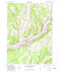
1943 Map of Schenevus
USGS Topo · Published 1983About this map
The Delaware and Hudson railroad corridor dictates the settlement patterns of this central Otsego County landscape, following the valley of Schenevus Creek. The village of Schenevus serves as a primary hub, flanked by smaller hamlets like Chaseville and Tuscan. This 1943 survey, updated with 1980s data, reveals a rural economy transitioning from early twentieth-century school districts to consolidated systems, evidenced by the numbered landmarks like School No 8 and School No 16 scattered across the hillsides. The terrain rises sharply from the valley floor to high points such as Hooker Mountain and Badeau Hill. In the north and west, Hooker Hill State Forest and South Hill State Forest preserve large tracts of timberland, while local genealogy is rooted in several rural burial grounds including Maple Grove Cem and Bliven Cem.
Find a feature on this map
40 named features on this map. Tap any name to fly to it.
Don’t see what you’re looking for? This feature index may not catch every label — zoom into the map to look around manually.
Map Details
Editions of this 1943 Schenevus Map
4 editions found
Other maps of this area

1904 · Richmondville
USGS Topo · 1:62,500

1904 · Hobart
USGS Topo · 1:62,500

1907 · Cooperstown
USGS Topo · 1:62,500

1909 · Cooperstown
USGS Topo · 1:62,500

1909 · Delhi
USGS Topo · 1:62,500

1911 · Delhi
USGS Topo · 1:62,500

1943 · Milford
USGS Topo · 1:24,000

1943 · South Valley
USGS Topo · 1:24,000

1943 · Westford
USGS Topo · 1:24,000

1943 · Charlotteville
USGS Topo · 1:24,000