
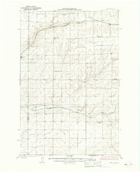
1925 Map of Schrag
USGS Topo · Published 1925About this map
Batum and Schrag anchor this agricultural landscape in the mid-1920s, showing a region defined by its reliance on two major rail arteries. The Chicago Milwaukee and St Paul cuts through the northern coulees near Moody, while the Northern Pacific serves the southern settlements. This era reflects a highly localized social structure, evidenced by the high density of rural schools such as the Schaffer School, Gering School, and Weber School, each serving families within walking or riding distance.
Find a feature on this map
25 named features on this map. Tap any name to fly to it.
Don’t see what you’re looking for? This feature index may not catch every label — zoom into the map to look around manually.
Map Details
Editions of this 1925 Schrag Map
2 editions found
Other maps of this area

1916 · Connell
USGS Topo · 1:125,000

1918 · Connell
USGS Topo · 1:125,000

1923 · Wheeler
USGS Topo · 1:62,500

1924 · Othello
USGS Topo · 1:62,500

1925 · Wheeler
USGS Topo · 1:62,500

1953 · Walla Walla
USGS Topo · 1:250,000

1953 · Ritzville
USGS Topo · 1:250,000

1954 · Warden
USGS Topo · 1:24,000

1954 · Othello
USGS Topo · 1:62,500
1956 · Bassett Junction
USGS Topo · 1:24,000