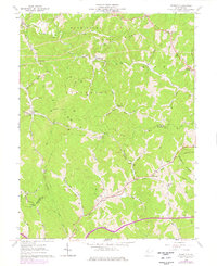
1961 Map of Schultz
USGS Topo · Published 1976About this map
The hills of Pleasants and Ritchie Counties are deeply etched by a network of runs and ridges in this early 1960s topographic record. The landscape is defined by its small, creek-side settlements and upland crossings, such as the community of Schultz and the riverside landing at Maxwell. Local life centered around a series of country sanctuaries, including Cloverdale Ch and Mt Zion Ch, which served the scattered residents of the Washington, Jefferson, and Grant districts.
Find a feature on this map
54 named features on this map. Tap any name to fly to it.
Don’t see what you’re looking for? This feature index may not catch every label — zoom into the map to look around manually.
Map Details
Editions of this 1961 Schultz Map
3 editions found
Other maps of this area

1904 · Marietta
USGS Topo · 1:62,500

1906 · Saint Marys
USGS Topo · 1:62,500

1906 · Elizabeth
USGS Topo · 1:62,500

1907 · Harrisville
USGS Topo · 1:62,500

1924 · St Marys
USGS Topo · 1:62,500

1924 · Harrisville
USGS Topo · 1:62,500

1924 · Marietta
USGS Topo · 1:62,500

1924 · Elizabeth
USGS Topo · 1:62,500

1926 · Elizabeth
USGS Topo · 1:62,500

1926 · Harrisville
USGS Topo · 1:62,500