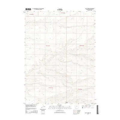
2015 Map of Scott Spring
USGS Topo · Published 2015About this map
Greasewood Canyon carves through the high desert of Sweetwater County, defining the drainage patterns and physical orientation of this arid landscape. This 2015 survey reflects the enduring character of Wyoming's public land survey system, clearly demarcating the boundaries of Townships 19 through 21 North and Ranges 106 and 107 West. Aside from the vital water source at Scott Spring, the area is primarily defined by the grid of local infrastructure, including CO Road 53 and CR-14. These routes trace the contours of the high plateaus, providing essential access to this open expanse of the American West. The map captures a moment of modern continuity in a region where geography remains the primary driver of human movement.
Find a feature on this map
10 named features on this map. Tap any name to fly to it.
Don’t see what you’re looking for? This feature index may not catch every label — zoom into the map to look around manually.
Map Details
Editions of this 2015 Scott Spring Map
This is the sole edition of this map. No revisions or reprints were ever made.
Other maps of this area

1954 · Rock Springs
USGS Topo · 1:250,000

1958 · Rock Springs
USGS Topo · 1:250,000

1961 · Scott Spring
USGS Topo · 1:24,000

1961 · Peru
USGS Topo · 1:24,000

1961 · Pilot Butte
USGS Topo · 1:24,000

1961 · Austin Ranch
USGS Topo · 1:24,000

1961 · Kanda
USGS Topo · 1:24,000

1961 · Green River
USGS Topo · 1:24,000

1962 · Rock Springs
USGS Topo · 1:250,000
1963 · Chrisman Ranch
USGS Topo · 1:24,000