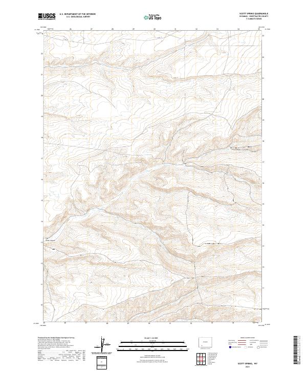
2021 Map of Scott Spring
USGS Topo · Published 2021About this map
Scott Canyon carves through this arid portion of Sweetwater County, defining the drainage patterns in a landscape marked by dramatic elevation changes. The land is largely defined by the Public Land Survey System grid, which is clearly delineated by township and range boundaries including t20n r107w and t19n r106w. This 2021 survey by the U.S. Geological Survey shows a territory where human presence is sparse, limited primarily to a few established transit routes like Co RD 14 and Co RD 53. The namesake Scott Spring serves as a critical water source in the eastern portion of the quadrangle, illustrating the importance of natural springs for both livestock and wildlife in this high-desert environment.
Find a feature on this map
10 named features on this map. Tap any name to fly to it.
Don’t see what you’re looking for? This feature index may not catch every label — zoom into the map to look around manually.
Map Details
Editions of this 2021 Scott Spring Map
This is the sole edition of this map. No revisions or reprints were ever made.
Other maps of this area

1954 · Rock Springs
USGS Topo · 1:250,000

1958 · Rock Springs
USGS Topo · 1:250,000

1961 · Scott Spring
USGS Topo · 1:24,000

1961 · Peru
USGS Topo · 1:24,000

1961 · Pilot Butte
USGS Topo · 1:24,000

1961 · Austin Ranch
USGS Topo · 1:24,000

1961 · Kanda
USGS Topo · 1:24,000

1961 · Green River
USGS Topo · 1:24,000

1962 · Rock Springs
USGS Topo · 1:250,000
1963 · Chrisman Ranch
USGS Topo · 1:24,000