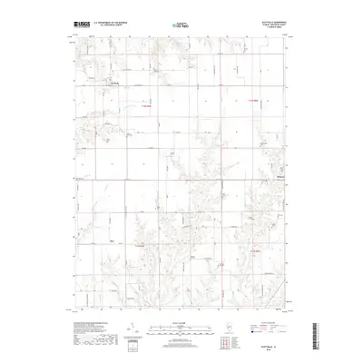
2018 Map of Scottville
USGS Topo · Published 2018About this map
Scottville and Palmyra anchor this Macoupin County landscape, where the rural grid is defined by a high concentration of family and community burial grounds. The territory between these settlements is drained by a complex network of waterways, including Panther Creek, Negro Lick, and Solomon Creek. This pattern of small creeks and branches has historically shaped the placement of local cemeteries such as Hettick Point Cem and Ruyle Cem. The map reveals a deeply rooted agricultural community where legacy family names are preserved on the land through features like Miller Branch and Nifong Cem. The small community of Barr sits in the southwest, connected to the larger hubs by a system of country roads like Palmyra Road and North Scottville Road that navigate the undulating terrain surrounding Little Negro Lick and Rock Branch.
Find a feature on this map
86 named features on this map. Tap any name to fly to it.
Don’t see what you’re looking for? This feature index may not catch every label — zoom into the map to look around manually.
Map Details
Editions of this 2018 Scottville Map
This is the sole edition of this map. No revisions or reprints were ever made.
Other maps of this area

1923 · Carlinville
USGS Topo · 1:48,000

1924 · Waverly
USGS Topo · 1:62,500

1925 · Carlinville
USGS Topo · 1:62,500

1926 · Waverly
USGS Topo · 1:62,500

1931 · Carlinville
USGS Topo · 1:62,500

1932 · Greenfield
USGS Topo · 1:62,500

1932 · Jacksonville
USGS Topo · 1:62,500

1937 · Jacksonville
USGS Topo · 1:62,500

1948 · Quincy
USGS Topo · 1:250,000

1956 · Quincy
USGS Topo · 1:250,000