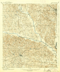
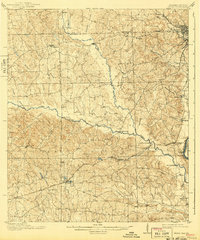
1914 Map of Seale
USGS Topo · Published 1939About this map
The Central of Georgia RR and the Columbus and Southern RR define the transportation network of Russell County just before the First World War. This survey captures a rural landscape transitioning into the 20th century, anchored by the county seat of Seale. Along the eastern edge, the industrial hubs of Phenix City and Girard sit perched above the Chattahoochee River, marking the border with Georgia. The interior is characterized by an intricate web of water crossings, including Perrys Ford and Nuckolls Bridge over the winding Uchee Creek.
Find a feature on this map
46 named features on this map. Tap any name to fly to it.
Don’t see what you’re looking for? This feature index may not catch every label — zoom into the map to look around manually.
Map Details
Editions of this 1914 Seale Map
6 editions found
Other maps of this area

1907 · Talbotton
USGS Topo · 1:125,000

1907 · Opelika
USGS Topo · 1:125,000

1908 · Columbus
USGS Topo · 1:62,500

1909 · Opelika
USGS Topo · 1:125,000

1914 · Seale
USGS Topo · 1:62,500

1929 · Columbus
USGS Topo · 1:48,000

1947 · Columbus
USGS Topo · 1:62,500

1949 · Fort Mitchell
USGS Topo · 1:24,000

1949 · Julia
USGS Topo · 1:24,000

1949 · Columbus
USGS Topo · 1:24,000